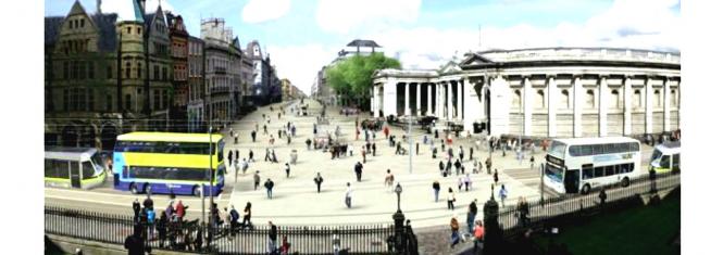
FLOW is a European Union funded project under the Horizon 2020 research and Innovation Programme. The purpose of the FLOW project is to develop the tools and techniques required for predicting the impact of walking and cycling on overall congestion.
Dublin was selected as a partner city for the FLOW project and Clifton Scannell Emerson Associates were appointed by Dublin City Council to develop a multi modal microscopic model for the city centre including the new LUAS lines, planned cycle infrastructure and the proposed pedestrianised plaza at College Green along with the associated rerouting of bus services.
Video of CSEA's full model run can be viewed by clicking HERE
Tasks and Methodology:
- Data Collection, including additional origin-destination surveys
- Modelling of existing scenario and street layout, including observation of existing driver and pedestrian behaviours
- Modelling and evaluation of various proposed options
- Selection of preferred option
- Further modelling of Preferred Option to refine simulation of road user movements and behaviour, particularly interaction of pedestrians with cyclists and public transport.
- 3D modelling of public realm based on Preferred Option
- Video rendering of final simulation for presentation purposes
Some key findings from the study include:
- The total emissions of Carbon Monoxide (CO), Nitrous Oxides (NOx) and Volatile Organic Compounds are reduced by 18.75% in the proposed network when compared to the base model.
- The emissions on the key public realm corridor from Dublin Castle to O’Connell St along Dame St, College Green, Westmoreland St and O’Connell Bridge are reduced by 31%.
- The total number of people moving between College Green / Grafton Street Lower and Thomas Moore Island has increased while also reducing the total number vehicles in the peak hour with corresponding the air quality, noise level, safety and public realm improvements
This project involved extensive use of the microscopic traffic modelling software VISSIM developed by PTV Group, including the use of vehicle actuated control add-on VisVAP to simulate the proposed actuated LUAS priority system at O’Connell Bridge and Westmoreland St.

